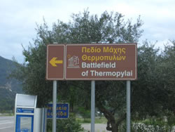
 The pass of Thermopylae is approximately 200 km north by road from Athens and is today approached in the easiest manner
possible, i.e.. by modern highway (The National Road E75).
The pass of Thermopylae is approximately 200 km north by road from Athens and is today approached in the easiest manner
possible, i.e.. by modern highway (The National Road E75).
The battlefield in its present state can be compared to a roadside attraction at which many tour buses, on their way to and from other destinations in Greece, stop.
Private motorists also pause in no small numbers and the police have an ingenious speed trap just up the road as well! There is parking, just before the monument, on the right hand side heading north and on the opposite side too.
This is a free site and there are several explanatory signs describing the battle. I don't know about you but its a bit hard to imagine events of 2,000 years ago with cars, trucks and buses whizzing by a few feet away at 120 km per hours.
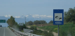
Like I said this is a free site and the road has to pass though here for obvious reasons like the snow capped Kalidromon mountains in the picture right. Kalidromon in Greek, incidentally means: Kali (good) Dromon (road/path).
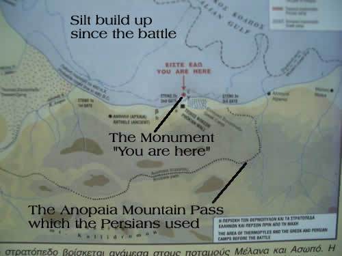
The topography of the battlefield has changed quite radically over the millennia due to silt deposits from the Spercheois River. Its much wider (5km) now than it was then as the map left shows in the "you are here" section.

Why not enjoy Harry's Free Musical Compositions while you read this site? (opens seperately)
©Harry's Greece Travel Guides