 Along the with the Samaria Gorge in western Crete (see below), the Vikos Gorge (left) in the Pindos mountains of Ipiros (Epiros) draws huge numbers of tourists every year, and is hence the most visited destination in this region.
There are claims that it is the deepest gorge in the world, which it may or may not be.
But is, in any case, very deep and well worth the trek for the hardy traveler, though there are also paths with easier access for those who are less so.
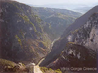 This area is found north of Ioannina, not far from the Albanian border. The gorge is about 20 km (12.4 miles long), and runs through a flank of the Astraka mountain. At the bottom of the gorge is the Voidomatis River (whose name means, 'Eye of the Ox').
Above the gorge, near the village of Monodendhri, are some very fine forest, with a mix of trees very typical of the Balkans: maples (several kinds), hazel, hornbeam, elm, cherry, horse chestnut (of a native variety), and others. The path from this village down into the gorge traverses this forest, with some grassy and rocky ledges as well.
Many kinds of flowers are found in the open clearings in the forest. In the gorge there are willows, planes, alders, and cornelian cherry, and many amphibians and dragonflies, butterflies and birds. A dirt track also leads upward from Monodhendri to Oxia, where there are some marvelous views from the top of very steep cliffs, also a good area to see many flowers, butterflies, as well as eagles and peregrines. The gorge is best visited between April and early December, and there are guide books and maps for sale in Ioannina.
 Within the park are found the peaks of Mt. Tymfi which rise impressively above the gorges of Vikos and Aoos. These are Astraka (2436 meters or 7990 feet) and Gamila (2497 meters or 8190 feet).
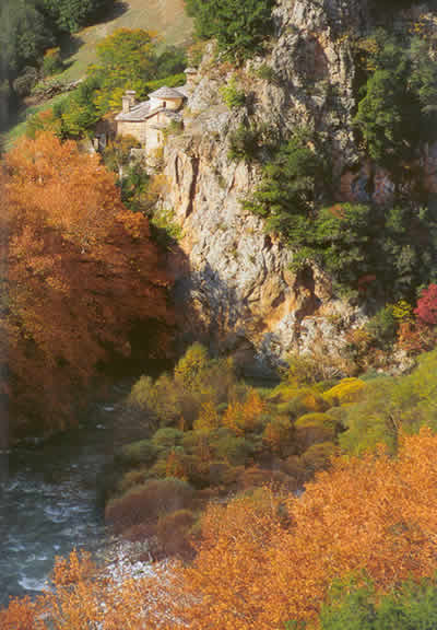
This is an area that has no access by car road whatsoever; on foot, access is best from the west, with the beautiful stone village of Mikro Papingo on the slopes, below Astraka. This village is one of the most photographed places in Ipiros, with its dramatic mountain 'buttresses' behind it, the scenery almost resembling New Mexico in some postcards.
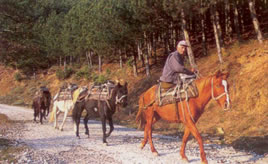 The village is one of the Zagoria villages, which number around forty, and in which many traditional stone houses have been restored for tourist accommodation. From Mikro Papingo, a good mule path leads up about 1000 meters (3,280 feet) to the first main ridge of Astraka, where food and drink are available. This track passes through pastures and woods, then forest, then screes and sheep pastures. After reaching the refuge, flowers and birds abound, with the types of flowers quite numerous, especially on the slope below the refuge facing northeast (best in June), and there are many butterflies in more sheltered spots.
Lakes and marshy areas are found at the bottom of the slope, with Drakolimni (Dragon Lake) beyond, on the slopes of Mt. Gamila and on the edge of the Aoos Gorge. There are various paths up into these mountains, a fine one leading from the village of Skamneli.

Why not enjoy Harry's Free Musical Compositions while you read this site? (opens seperately)
©Harry's Greece Travel Guides